The Short Answer
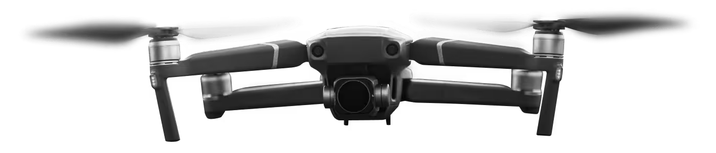
An AI drone uses onboard processors, cameras and motion sensors to understand its surroundings and make flight decisions without a pilot constantly moving sticks. The pilot sets a goal — follow this person, fly this mission, return home — and the drone handles the how.
That is a useful simplification. The full picture involves several hardware and software layers working together every fraction of a second.
The Sensor Stack
Modern AI drones carry multiple sensor types simultaneously. Each one fills a gap the others leave.
GNSS (GPS, GLONASS, Galileo, BeiDou) — satellite positioning gives horizontal accuracy down to roughly one meter for consumer drones, and centimeter-level for survey-grade RTK platforms. GNSS handles outdoor navigation but fails indoors and near tall buildings.
IMU (Inertial Measurement Unit) — accelerometers and gyroscopes measure movement and tilt many hundreds of times per second. The IMU keeps the drone stable even when GNSS drops out briefly.
Downward optical flow sensors — cameras pointed at the ground track surface texture. This lets the drone hold position indoors or in low-GPS environments by measuring how fast the ground pattern moves beneath it.
Obstacle avoidance sensors — these come in several forms: infrared (short-range, low power), stereo vision (two cameras that measure depth like human eyes) and ToF (time-of-flight, measures distance using light pulses). Premium drones combine two or three types covering multiple directions.
Barometer — measures air pressure to estimate altitude. Less precise than GNSS altitude but works instantly and never loses signal.
The Vision Processing Pipeline
Cameras on an AI drone do more than record footage. A dedicated vision processing unit (VPU) analyzes the image stream in real time.
Here is what that looks like in practice for subject tracking:
- Camera detects a person-shaped blob in the frame
- VPU identifies it as a human using a trained neural network model
- The drone locks position data to that subject
- Every new frame, the system recalculates distance and angle
- Flight controllers adjust motor speeds to keep the subject centered
This all happens faster than you can blink. High-end drones run this pipeline at 30 frames per second or more.
Autonomous Flight Modes
Different autonomy modes use the sensor stack in different combinations.
Waypoint missions — you draw a path on a map app. The drone flies each GPS coordinate in order, adjusting altitude and camera angle as programmed. Used heavily in mapping and surveying and infrastructure inspection.
Follow-me mode — uses subject tracking (vision or GPS beacon from a controller) to keep the drone a set distance and angle from a moving person. Popular in sports filming and aerial photography.
Return-to-home (RTH) — when battery is low or signal is lost, the drone climbs to a safe altitude and navigates back to the takeoff point. A basic safety net that every AI drone includes.
Active obstacle avoidance — during any of the above, the avoidance system runs in parallel. If a tree appears in the flight path, the drone pauses, recalculates, and routes around it — or stops and hovers if no clear path exists.
Where AI Drones Still Struggle
Worth knowing before you buy: current AI does not handle every situation gracefully.
Reflective surfaces like water and glass confuse stereo vision sensors. Rain and dust degrade camera-based systems. Dense forests create GPS multipath errors. And the “AI” labeling on budget drones sometimes covers very limited autonomy — a single-axis follow mode, for example, that drops the subject in turns.
Before purchasing, check which specific sensors a drone carries and how many obstacle avoidance directions it covers. A drone with forward-only avoidance is very different from one with omnidirectional coverage.
Browse our professional AI drone range or read our buying guide for beginners to compare specific models by sensor configuration and use case.